Martin MPO Development Review Interactive Map:
This GIS map is intended to assist the Martin MPO track all developments in the unincorporated Martin County and within Stuart, Sewall’s Point, Ocean Breeze, Indiantown, and Jupiter Island. The map allows the public and staff to see the spatial relationship between development throughout Martin County and assists the MPO Policy Board in setting transportation project priorities.
MC Maps Proposed Developments:
This map is used for finding proposed developments within unincorporated Martin County.
City of Stuart Development Web Application:
Web Application that contains development related data within the City of Stuart.
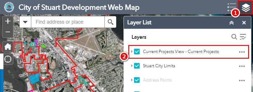
To turn on the Current Project Layer, click the Layer List icon in the upper right-hand corner (#1). Once the Layer List appears below, check the Current Projects View – Current Projects selection (#2). Afterwards, the current projects will be highlighted in different colors on the map. See screenshot below.